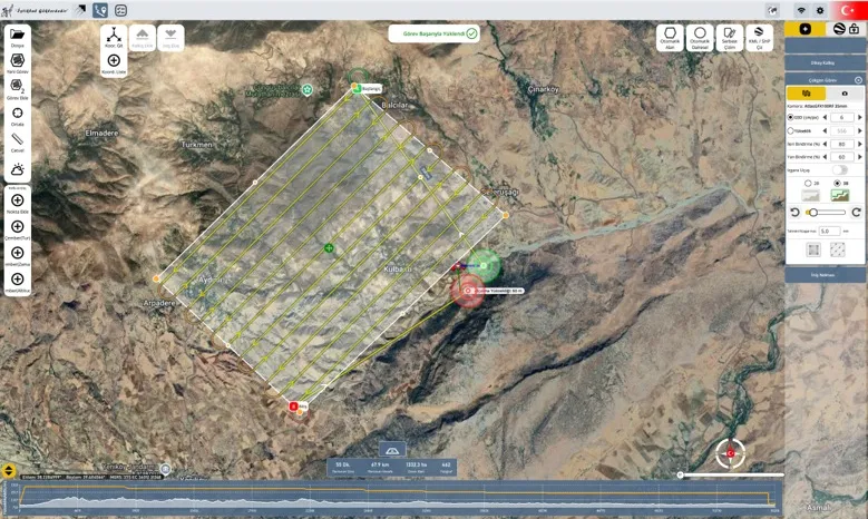
Planning module
Plans missions on the three-dimensional globe, builds routes and configures operational scenarios. For survey missions it generates flight lines from the selected camera and overlap ratios.
Planning, command and control software for unmanned aerial vehicles
REGIS is an integrated planning, command and control software built for photogrammetric and operational unmanned aerial vehicle missions, with support for several aircraft at once. Mission planning, flight management, precise positioning and post-flight analysis sit within one structure.
A mission runs through a chain of steps, from setting the area to be covered to analysing the flight afterwards. REGIS carries all of those steps in one interface, so moving between planning, flight and assessment does not mean changing software.
Planning, live flight and test are modules of the same interface. All three work over a shared three-dimensional globe view.
Plans missions on the three-dimensional globe, builds routes and configures operational scenarios. For survey missions it generates flight lines from the selected camera and overlap ratios.
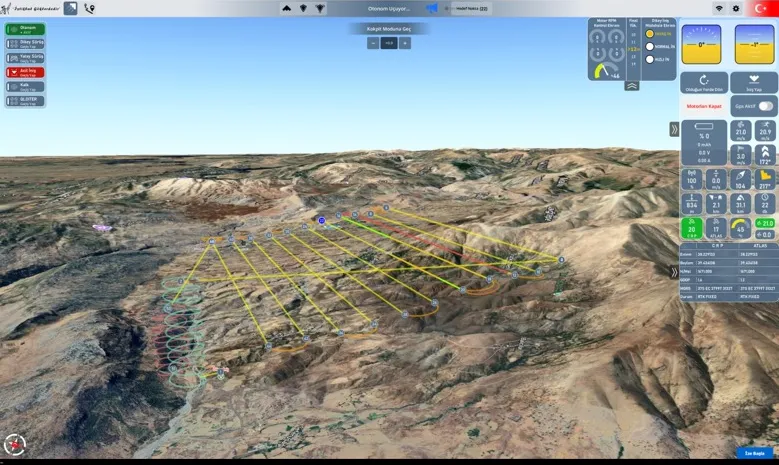
Shows flight data on the three-dimensional globe in real time. Several aircraft are commanded from the same screen, so the operation is run from one centre.
Runs test procedures on the three-dimensional model that serves as the digital twin of the aircraft. Motors, control surfaces and sensor data are followed on the model at the same time.
The mission is built on the map, and after take-off that same mission is followed over the terrain. Both screens are part of the same interface.